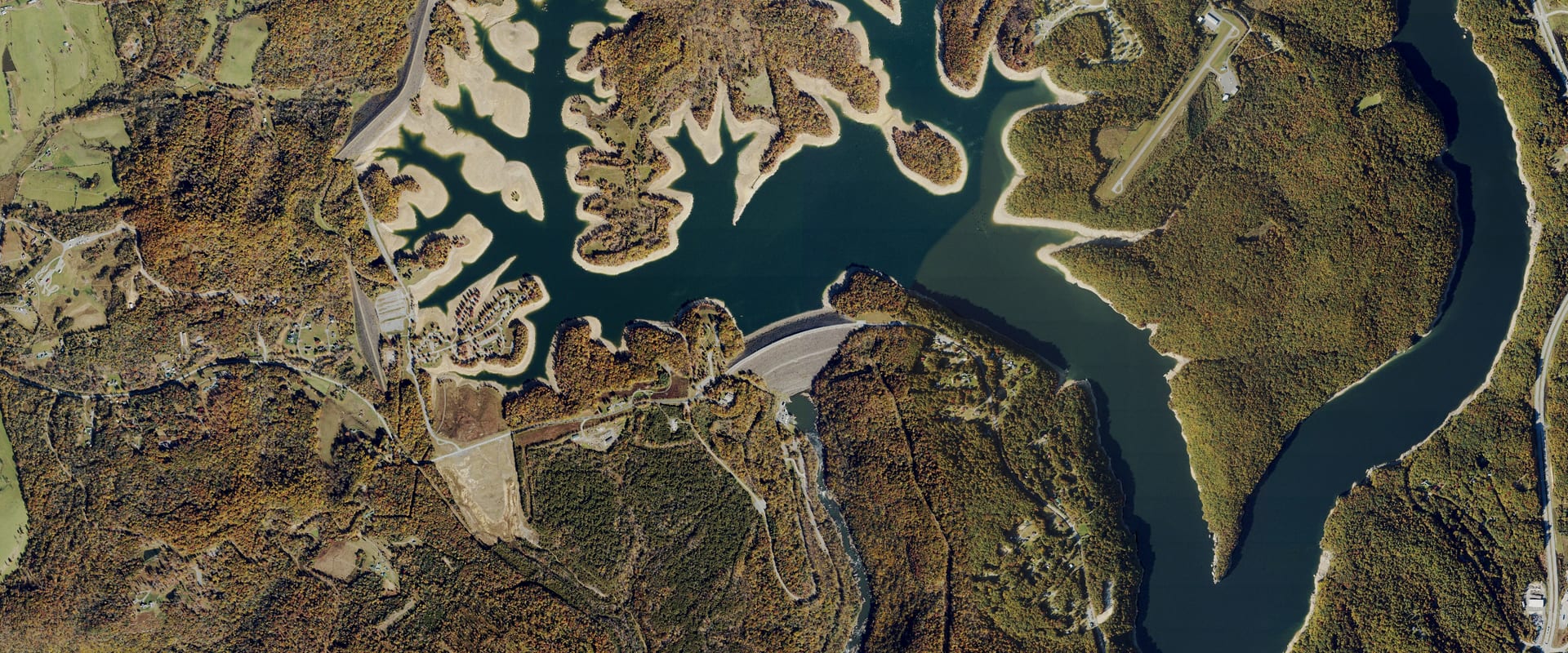
Summersville Lake Water Level Today
17.2 ft below full pool, 74.6% full (of this season's full pool), and 22.8 ft higher than a year ago.
Read Oct 26, 3:00 PM EDT
Trend and source week, month, year
Source: U.S. Army Corps of Engineers. Check it at www.lrh-wc.usace.army.mil/wm/?basin/kan/sum
Summersville Lake boat ramps
The Corps reports 3 open, 0 partly open and 1 closed of 4 recreation areas, as of its page dated 10/23/26. Status is for the whole area, not a measure of water at the ramp.
2 of 4 ramps have no map location yet.
- Battle Run Open
- Long Point Launch Ramp Open
Day use only
- Salmon Run Open
Day use only
- Damsite Closed
Day use only
Status: U.S. Army Corps of Engineers Recreation Operational Status, refreshed daily; locations where shown from the Corps or the state agency named in the sources list. Level: read Oct 26, 3:00 PM EDT.
Summersville Lake, West Virginia. Run by USACE Huntington District.
Summersville Lake level
Daily level, past 12 months, feet above sea level (NGVD29). Shaded: the normal range, the middle half of readings for each date, 2020 to 2025. U.S. Army Corps of Engineers.
Monthly average since Aug 13, 2020; gaps where the record is missing. U.S. Army Corps of Engineers.
About Summersville Lake today
How full is Summersville Lake?74.6% full, 17.2 ft below full pool
74.6% full by storage on Oct 26. Between the top of inactive pool (1,465.5 ft) and today's top of normal pool (seasonal; 1,652 ft summer recreation pool).
Full pool is 1,652.00 ft, the operator's target for this time of year.
How low is Summersville Lake?117.4 ft above its lowest since 2020
17.2 ft below full pool. The lowest daily level in our record since 2020 is 1,517.33 ft, on Dec 9, 2021.
Is Summersville Lake still dropping?Yes: down 4.24 ft this week
| Change | Feet | Level then |
|---|---|---|
| Past day (since Oct 25) | 0.31 down | 1,635.08 |
| Past 7 days (since Oct 19) | 4.24 down | 1,639.01 |
| Past 30 days (since Sep 26) | 15.41 down | 1,650.18 |
| Past year (since Oct 26, 2025) | 22.84 up | 1,611.93 |
Is Summersville Lake normal for this time of year?13.7 ft above normal for this date
Normal for Oct 26 is 1,621.11 ft: the median of 42 daily readings within 3 days of this date, 2020 to 2025. Summersville Lake is 13.7 ft above it.
What is the water temperature at Summersville Lake?No official reading for this lake
No USGS in-lake water-temperature gauge found within the lake area (checked 2026-10-24). Stream gauges above or below the dam were not used: tailwater and inflow temperatures differ from the lake surface.
When was Summersville Lake last full?Sep 11, 2026
The last day in our record at or above 1,652.00 ft, today's full pool.
Summersville Lake full pool level1,652.00 ft
Full pool changes with the season; this is the operator's target for today. Elevations are feet above sea level (NGVD29).
Where it comes from: USACE CWMS location level "Summersville.Elev.Inst.0.Top of Normal" (refreshed daily; seasonal where the Corps sets a seasonal pool). Checked 2026-10-24. Summer recreation pool is 1,652 ft; the winter pool is about 1,575 ft.
Summersville Lake this time last year1,611.9 ft on Oct 26, 2025
22.8 ft higher than a year ago.
Levels: U.S. Army Corps of Engineers, read Oct 26, 3:00 PM EDT. Normal and records come from Creek & Lake's stored daily history (2,256 days since 2020); they aren't official unless the operator publishes the same value.
Stocked trout waters near Summersville Lake
The 12 closest trout waters whose nearest tracked lake is Summersville Lake, measured in a straight line to Summersville Lake's dam or gauge.
-
Summersville Lake (Tailwaters)
Nicholas County · Stream
Stocked 9 times in 2026: Mar 19, Apr 3, Apr 16, Apr 29, May 14, Oct 19 and earlier.
Where it's stocked, per WV DNR: Stocked from the dam 2 miles downstream.
-
Mill Creek (Fayette)
Fayette County · Stream
Stocked 4 times in 2026: Feb 17, Mar 12, Apr 21, May 19.
Where it's stocked, per WV DNR: Stocked from WV Secondary Route 5 bridge, near Ames Heights, downstream to within 0.5 miles of New River outside Ansted.
-
Cherry River
Nicholas County · Stream
Stream flow 454 cubic feet per second, water 53°F, read Oct 26, 3:00 PM EDT at Gauley River Near Craigsville (USGS 03189100, gauge 0.3 mi away).
Stocked 8 times in 2026: Mar 4, Mar 19, Apr 3, Apr 16, Apr 29, May 14 and earlier.
Where it's stocked, per WV DNR: Stocked from Richwood downstream 9.8 miles to the mouth.
-
Indian Rock Lake
Nicholas County · Lake
Stocked 4 times in 2026: Feb 18, Mar 18, Apr 22, May 9.
-
Laurel Creek of Cherry River
Nicholas County · Stream
Stream flow 36 cubic feet per second, read Oct 26, 4:00 PM EDT at Laurel Creek Near Fenwick (USGS 03188900, gauge 0.0 mi away).
Stocked 4 times in 2026: Feb 11, Mar 10, Apr 14, May 13.
Where it's stocked, per WV DNR: Stocked from Jettsville upstream 1.5 miles to ford.
-
Glade Creek of Mann
Fayette County · Stream
Stocked 8 times in 2026: Mar 11, Mar 27, Apr 8, Apr 24, May 6, May 19 and earlier.
Where it's stocked, per WV DNR: Stocked from Manns Creek upstream through Babcock State Park, 2 miles, ending at park boundary.
-
Laurel Creek of New River
Fayette County · Stream
Stocked 4 times in 2026: Feb 17, Mar 12, Apr 21, May 19.
Where it's stocked, per WV DNR: Stocked from the Beckwith Dam upstream to the mouth of Dempsey Branch.
-
Buffalo Creek (Clay)
Clay County · Stream
Stocked 4 times in 2026: Feb 18, Mar 18, Apr 22, May 5.
Where it's stocked, per WV DNR: Stocked from just below CR 15 and CR 15-2 junction upstream 2.2 miles to Railroad Bridge.
-
Boley Lake
Fayette County · Lake
Stocked 8 times in 2026: Mar 6, Mar 19, Apr 1, Apr 15, Apr 30, May 13 and earlier.
-
Big Clear Creek
Greenbrier County · Stream
Stocked 9 times in 2026: Mar 25, Apr 10, Apr 22, May 7, May 20, Oct 21 and earlier.
Where it's stocked, per WV DNR: Stocked from Kessler upstream 11.5 miles along WV Secondary Rt. 1 to Clearco.
-
Cranberry River
Webster County · Stream
Stream flow 82 cubic feet per second, water 50°F, read Oct 26, 3:00 PM EDT at Cranberry River Near Richwood (USGS 03187500, gauge on this stream).
Stocked 16 times in 2026: Apr 29, May 8, May 15, May 20, May 28, Oct 20 and earlier.
Where it's stocked, per WV DNR: Stocked in a 14.3-mile section from the Woodbine Recreation Area to the mouth of Dogway Fork.
-
North Fork of Cherry River
Greenbrier County · Stream
Stocked 8 times in 2026: Mar 13, Mar 26, Apr 8, Apr 23, May 8, May 22 and earlier.
Where it's stocked, per WV DNR: Stocked from 0.25 miles above the Catch & Release Area upstream 10 miles along WV Rt. 39 to bridge near Carpenter Run.
Stocking: WV DNR. Distances are straight-line.